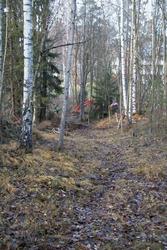
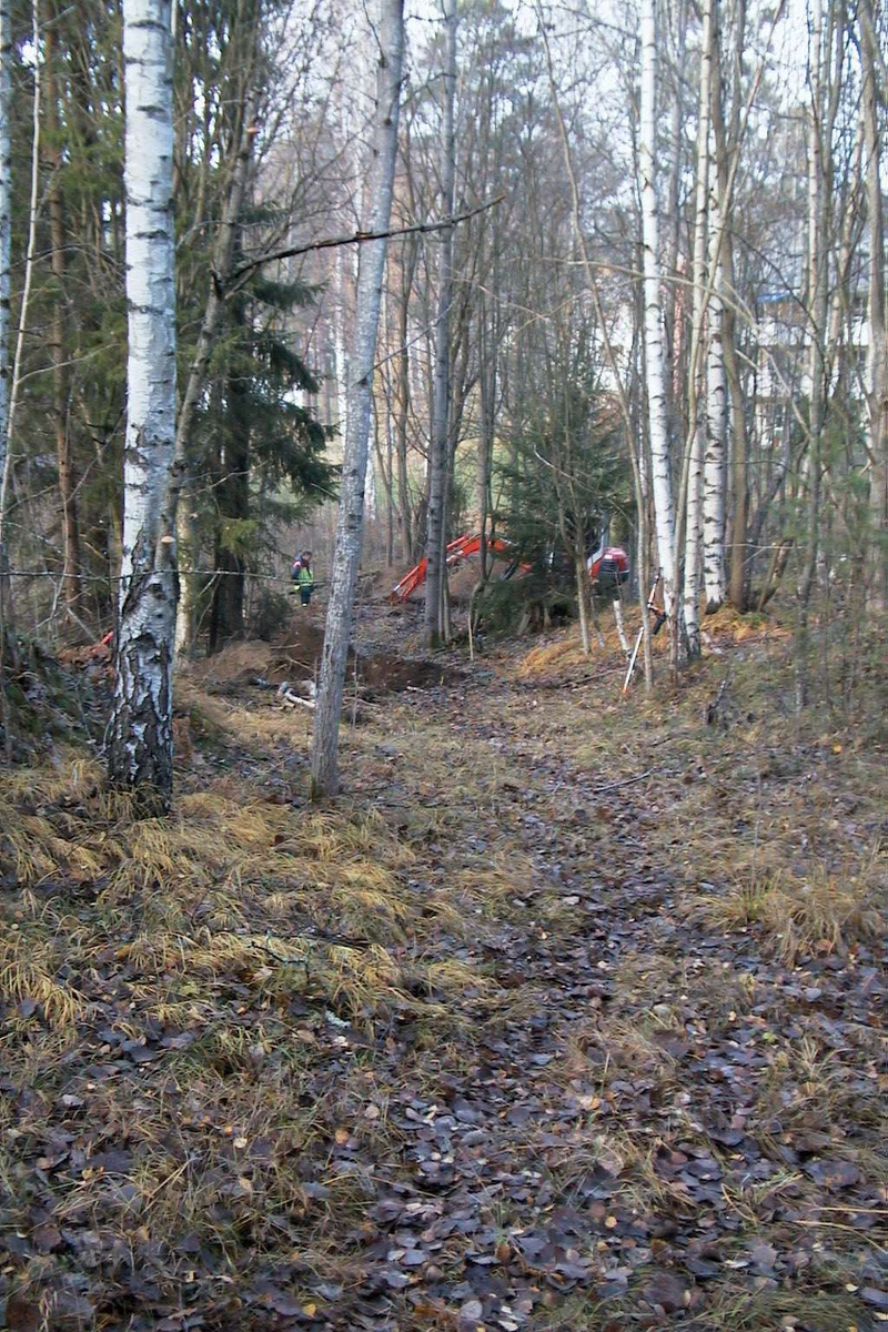
Vägen låg i en sluttning, schakt grävdes på tre platser, varav det grävda Schakt 3 syns i förgrunden och Schakt 2 är under grävning i bakgrunden, foto från söder
I november 2003 utfördes en arkeologisk slutundersökning av en vägsträckning (raä 90), känd från historisk tid, i Kalmarsand, Kalmar socken. Anledningen var planerat bostadsbygge på platsen. Syftet med undersökningen var att kartera och, om möjligt, datera vägen samt att söka spåra denna i det historiska kartmaterialet.
Vid fältarbetet karterades den berörda vägsträckningen med totalstation, och tre schakt grävdes tvärs över vägen med grävmaskin.
Vägen låg i en norrsluttning längs med strandlinjen i Kalmarsand. Bredden var mellan tre och fyra meter. I söder skar vägen in i den sandiga sluttningen och hade en närmast skålad profil. Vägens mellersta parti hade istället en ungefär 0,5 m hög, uppbyggd vägbank. Längst i norr syntes ingen vägbank till. Här var vägen otydligare och marken flackare.
I ett av schakten påträffades moderna fynd, bl a glas från vad som troligen var ett lysrör eller en glödlampa, ungefär 0,3 m under markytan. Detta visade att delar av de påförda eller pålagrade sand- och gruslagren tillkommit i sen tid. Från det äldsta lagret i samma schakt daterades en kolbit till vendeltid. Denna datering sätter visserligen en bakre gräns för vägens tillkomst, men det är mycket tveksamt om den har något samband med vägen. Bland annat de relativt låga nivåerna, ner till 7 m ö h, talar emot att vägen använts redan under vendeltid.
Den äldsta karta där vägens fortsättning finns utritad är från 1693. Själva undersökningsområdet var beläget på utmarken och karterades inte vid detta tillfälle. På 1784 års karta kallas vägen gamla landsvägen, och på häradskartan från 1860 och 1912 års karta finns den inte alls utritad. Att man fört på nytt grus under 1900-talet tyder dock på att vägen i praktiken använts senare. Vid undersökningstillfället var den fortfarande i bruk som gångstig.
")
")
Add a comment or suggest edits
To publish a public comment on the object, select «Leave a comment». To send an inquiry directly to the museum, select «Send an inquiry».