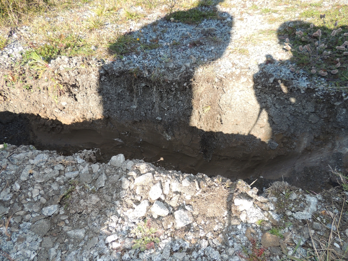
Arbetet bestod i att ett schakt, 180 meter långt, 0,5 meter brett och 0,35 meter djupt, skulle grävas med maskin, varefter en elkabel skulle läggas ner för att ansluta en nybyggd fastighet. Den arkeologiska kontrollen genomfördes vid två tillfällen den 2 och 9 oktober 2015. Vi det första tillfället visade det sig att ingen schaktning behövde göras i den sydvästra delen av den aktuella sträckningen, eftersom kabel kunde ansluta till ett befintligt elskåp. Resterande sträcka som skulle schaktas uppgick till cirka 110 meter.
Cirka 55 meter grävdes inom hagmarken i direkt anslutning till Litslena 32:1. I schaktet kunde det gamla matjordslagret observeras, ställvis även den orörda undergrunden. Inget av antikvariskt intresse påträffades. Cirka 55 meter grävdes inom vändplanen och uppfarten till Sneby gårds ekonomibyggnader. Även här kunde det äldre matjordslagret observeras.
Högre upp, i höjd med en silobyggnad, påträffades omkringrörda betongfundament, möjligen delar av en sentida grind, uppblandat med asfalt. Inget av antikvariskt intresse påträffades.
ArkivreferenserSkrivelse: Lucas, Robin 2015. Arkeologisk kontroll inom Litslena 32:1 och 34:1 på fastigheten Sneby 1:7, Litslena sn, Enköping kommun. lst dnr 431-4023-15.
")


")
Add a comment or suggest edits
To publish a public comment on the object, select «Leave a comment». To send an inquiry directly to the museum, select «Send an inquiry».