Miljö 21. Islandsberg, Jonsborg.
Bergig udde med bybildning och fyrplats från sent 1800-talet. Ensamgård på ö i Ellösfjorden med tillhörande utmarksholmar. Vackert och varierat kulturlandskap med ålderdomligt uppsplittrad åkerform.
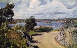
Längst ute på Skaftölandets sydspets ligger den bergiga udden Islandsberg. Söder härom, åtskild av Skallhavet och det smala Arsundet, ligger en ögrupp med Jonsborg som den största och enda bebyggda ön.
Så sent som vid 1700-talets slut var också Islandsbergsudden en ö, med broförbindelse över till Skaftölandet. Byn Islandsberg låg då samlad vid det ställe som idag kallas Ön. De odlingsbara dalgångarna runt om upptogs av ängs- och i någon mån åkermark. Fisket var en väl så viktig födkrok.
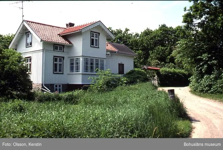
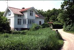
När man idag går den vackra, mjukt slingrande grusvägen från Lönndal ut mot Islandsberg passerar man ett lummigt och grönskande landskap, typiskt för Bohusläns inre kustlandskap. På den gamla byplatsen ligger husen vid Ön uppradade på ömse sidor av vägen.
Ett stycke väster om Ön ändrar plötsligt landskapet karaktär och övergår i vidsträckta, vindblåsta hällmarker. Längst ute vid Islandsbergs huvud, den fruktade passagen för sjöfarande, ligger den gamla fyrplatsen som var i drift från 1883 till början av 1930-talet. Härifrån är en vidunderlig utsikt över havet i väster.
Östra delen av ön Jonsborg genomkorsas av små, tidigare uppodlade dalgångar, som nu delvis är beväxta med skog. I centrum av denna del ligger Jonsborg 1:3, den enda gården på ön. Tomtplatsen omgärdas av tjocka skalmurar. Markerna runt omkring, som hålls öppna genom bete, visar ett vackert och innehållsrikt kulturlandskap med stenmurar, röjningsrösen och fint stensatta öppna dikesrännor.
Gården Jonsborg finns skriftligt belagd från 1576 och den nuvarande gårdsplatsen från åtminstone 1790-talet. Söder om denna, på ägan Jonsborg 1:2, har det funnits ytterligare en gårdsbebyggelse. Av denna återstår idag ett område med husgrunder vid Ängevik och i anslutning till dessa en öppen, betad ängsmark som bär spår av äldre odling.
Tillsammans med den kargare västra delen av ön har ett stort antal holmar söder och öster om ön fungerat som utmark till gården. På den största av dessa, Fredagsholmen, finns en muromgärdad och utdikad dalsänka som tidigare varit odlad. Inom muren finns också en husgrund och en stenskodd vattenkälla. Fläckvis på den sanka och magrare marken utanför finns små vegetationspartier mellan berghällar som verkar ha utnyttjats för hackeslåtter. Från en vik i söder leder en stenuppbyggd väg rakt igenom dalsänkan mot en vik i norr. Källa: "Kulturmiljöer Lysekils kommun sid. 218".

Add a comment or suggest edits
To publish a public comment on the object, select «Leave a comment». To send an inquiry directly to the museum, select «Send an inquiry».